Wednesday, December 28, 2016

6th St or 9th St: Which street will get a protected bike lane?


While the District Department of Transportation has pushed back the Eastern Downtown Protected Bike Lane project to 2018, they have also narrowed the project down to two options, alternative three on 6th St NW and alternative four on 9th St NW. I compared 6th and 9th street options to figure out which I prefer.

6th St NW would place a cycletrack or two-way protected bike lane on the east side of the street. 
9th St NW would also place a cycletrack or two-way protected bike lane on the east side of the street. 

Potential conflicts
6th St has three public parking garages, one alley leading to a parking garage, a fire station, and a Hampton Inn drop off lane, all of which are high conflict zones for cyclists. In comparison, 9th St has three garages but two are residential and one is for a hotel and combined with two narrow entrance and exit curb cuts. 9th St also has a gas station with two curb cuts but DC gas stations are an endangered species so I do not expect this one to be there in five years. While 6th St is two-way, 9th St is one-way for about one-third of its length which forces cyclists heading in the opposite direct to stop at a disproportionate number of traffic lights (which occurs on 15th St today). Despite that and in terms of conflicts and curb cuts, 9th St is the clear choice. See chart for more detailed comparison.

Neither option has major conflicts with bus service. 6th St only has one block of northbound bus service with no official stop. 9th St has only southbound bus service which would stop on the other side of the street. For only block between Constitution and Pennsylvania, there is a northbound bus stop and layover parking, but since buses only turn right into the facility and right to exit, the bike lane could between the bus lane and southbound traffic lanes.

Factoring impacting bike lane
Factors
6th St NW
9th St NW
length
1.6
1.7
Curb cuts
16
13
average curb cut per mile
0.1 or 528'
0.13 or 690'
Street intersections
20
19
average intersection per mile
0.08 or 422'
0.089 or 472'
Bike lanes intersected
6
7
Bus impact
minimal, D4 northbound for 1 block would only require a small pedestrian island or removal of a stop
minimal because all southbound except between Pennsylvania and Constitution bus stop requires curb separation as buses come in only from right and exit right
Northern connections
Florida Ave traffic sewer
U St and 9:30 Club
Southern connections
Constitution Ave midblock
9th St Expressway
Direct connection to mall
no
no
Number of churches' eyes poked
2
0
Number of church curbs touched
1 (Springfield Baptist Curch)
1 (New Bethel Baptist Church)
Destinations along route
residential, offices, and few restaurants/businesses
More restaurants and businesses and convention center
Future connections from MoveDC
4
4
Number of cars per day upper
11,600
14,800
Number of cars per day lower
15,700
13,600
Metro entrances
0
1
Number of bikeshare stations within 1 block
4
9
Existing bike to work (2013) by census tract (%)
5.6%
5.1%
Existing bike to work (2013) by census tract (#)
554
689

Connections
Both options have the almost the same amount of connections, 9th St connecting to New York Ave and 6th not. However, neither have a direct connection to the Mall which is a key destination. 9th St has an underground expressway and the National Gallery of Art Sculpture in the way. 6th ends midblock at the National Gallery of Art although it is easier on 6th to use Pennsylvania Ave to go one block and two traffic lights to the 4th St bike lanes. Making the same connection on 9th requires two more blocks and traffic lights or crossing over three lanes of expressway traffic to follow a narrow sidewalk. Widening this sidewalk would impact the Smithsonian Butterfly Habitats and putting one in on the other side of 9th would impact the maintenance access to the Pavilion Café. Any of that work is beyond the scope of the project and would require difficult negotiations with multiple federal stakeholders.

At the north end, 6th St dumps cyclists onto the Florida Ave traffic sewer although the blocks across the street have relatively calmed traffic. In terms of people biking to work per the 2013 American Community Survey, 554 or 5.6%, of residents whose census tract touches 6th St bike to work. While outside of the project area, 6th St connects to Howard University which has the census tract with the highest number of people riding to work in the entire city, 18.6% or 412, and there are several other tracts with high numbers nearby. In contrast, 9th St dumps cyclists onto Florida Ave and U St and also continues north. Future expansions could take it north along Florida Ave to the 11th St bike lanes. U St is a popular destination. 5.1% or 689 residents bike to work in census tracts touching 9th St, higher than 6th St. But in the downtown portion of the project, this drops to 0.4% and 0.6%, indicating that those areas are not at all bike friendly.

Given those factors, I think 9th St is the best option. There is less potential conflict, more businesses to attract riders, and a larger untapped rider base along its route. We will see what is eventually built.

For more:
http://dccycletrack.com/preliminary-alternatives.html
http://www.wemovedc.org/resources/Final/Part%202_Plan_Elements/Bicycle.pdf

Yellow=6th St
Blue=9th St
Red dots=Capital Bikeshare stations
Light green=bike lanes
Dark green=Pennsylvania Ave protected bike lane

Tuesday, December 20, 2016

Restoring the Inland Route

Until 2004, Amtrak trains ran between Boston, Worcester, Springfield and Hartford to New York and Washington, running inland instead of hugging the coast. While FRA recently rejected a plan to reroute high speed trains along this corridor, restoring regular train service between these cities is feasible, at a reasonable cost and for reasonable outcomes.

Existing conditions
Massachusetts’ three largest cities, Boston, Worcester and Springfield lack decent rail connections. While there is substantial commuter service between Boston and Worcester, only one train, the Lakeshore Limited, runs between Springfield, Worcester and Boston. Trains can only go 60mph, below the 79mph default for most track, and the line has a lot of curves. As a result, the train is slow, taking 2h15m-2h26m to go 98 miles, when driving can take about 1h30m without traffic. However at rush hour, the drive slows to 2h15m. CSX also heavily uses the Springfield-Worcester segment, meaning that any upgrade will require good negotiation skills to avoid costly CSX demands. Further down the track, Springfield, Hartford, and New Haven will soon receive hourly commuter rail service.

High potential demand for train service
Cities such as Worcester, Springfield and Hartford are ripe for additional service due to their size and proximity to larger cities such as Boston, New York, Philadelphia, and Washington. There is also demand between them as well, a recent study estimated some 428,000 passengers between Boston and New Haven, and that study did not include extending that service further down the NEC into Philadelphia and Washington. Also, these numbers were generated using conservative travel time and as a result, ridership and revenue is likely conservative. The study also estimated revenue to be about $18 million with fares average $42 but only for trips between Boston and New Haven and points in between.

Those larger cities’ effect can be dramatic. If trains are extended from New York through Springfield to Boston, revenue and averages fares would substantially exceed the study. When Virginia extended one Northeast Regional train from Washington to Lynchburg 2009, the train earned back its operating costs almost every year since. Its fares average about $60 which indicates that many passengers go beyond Washington to points north. However, attracting those passengers requires faster service than today’s infrastructure provides and extending trains from New Haven all the way to Washington. Amtrak dropped the service because it could offer 6h45m-7h35m service from Washington to Boston via Providence and adding back the service today without upgrades would result in an noncompetitive 9h travel time. See map below


Recent investments in other parts of the corridor will benefit this project.
·         In 2012, CSX sold the line between Boston and Worcester to MBTA and improvements are ongoing. For example, a 1 hour, nonstop commuter train began service between Boston and Worcester in 2016.
·         River Line between Springfield and Vermont is owned by commonwealth of Massachusetts and was recently upgraded
·         Hartford Line between Springfield, Hartford, and New Haven is being substantially upgraded for more trains
·         Springfield Union Station has been restored and has capacity for additional trains.

Additional investment
·         Boston-Worcester, 44 miles, 60mph top speed, 1h-1h15m, 35-44mph average speed
Raising the top speed to 79-90mph and modestly banking curves could reduce travel time to 45m, increasing average speeds to 59mph. Additional trains would have to run at off peak hours as South Station is close to capacity.
·         Worcester-Springfield 54 miles, 60mph top speed, 1h15m, 43mph average speed
Raising the top speed to 79-90mph and modestly banking curves could reduce travel time to 50m-1h, increasing average speeds to 54-65mph. While 39% of line has two tracks, heavy freight usage would require some sidings and second track although the line previously had two tracks and retains the old track bed and bridges. While the line is curvy, the curves are fairly broad, making banking easier. Unusually, there are only a handful grade crossings and none on major roads, providing substantial savings on crossing gates. 

A June 2016 study estimated $273-309 million in infrastructure costs.These costs can be broken into segments. An initial segment could restore a few trains without major travel time improvements and allow the state to gradually increase speeds and add trains as it obtains more funding. Given that Massachusetts has no problem spending billions on the South Coast Line or the infamous Green Line expansion, spending some transportation dollars on a project which connects the central part of the state may be politically feasible. See below for some cost estimates.
Note that Palmer station costs are estimated to be $12-14 million for a mere 9,600 riders.
The table below breaks down the cost of restoring a second track. Running few trains initially would reduce the amount second track needed.
 
Tables from study.
Typically, studies also include new railcars and locomotives as part the initial cost. I excluded that cost because initially, Connecticut and Massachusetts could pay Amtrak to extended some of its Northeast Regional trains from New York, just as Virginia did to get Amtrak into Lynchburg.

Service outcomes
Today
·         1 train between Boston and Springfield, 2h26m, averaging 40mph (Lakeshore Limited to Chicago)
Intermediate future
·         4 trains between Boston and Springfield, 2h3m, averaging 49mph, and continuing to Washington, 8h33m, averaging 54mph.
Far future
·         1 train between Boston, Springfield, and Albany 4h (Lakeshore Limited to Chicago)
·         1 train between Boston, Springfield, and Albany 4h
·         1 train between Boston, Springfield, White River Junction and Montreal 8h30m
·         2 trains between Boston, Springfield, and Brattleboro, 3h15m
·         5 trains between Boston and Springfield, 1h35m, averaging 62mph, and continuing to Washington, 8h5m, averaging 57mph. This travel time could be cut further by skipping some smaller Connecticut cities.  

Bottom line
Restoring the Inland route appears to be cost effective, especially if the study is as conservative as it appears to be. Eastern Massachusetts has successful commuter and intercity train service and sharing some of that success in the central and western part of the state could be politically feasible.

Saturday, December 17, 2016

Who bikes to work in Alexandria


The American Community Survey is put out by the Census Bureau and provides a neighborhood by neighborhood view into a variety of factors from income to housing. I was curious about how Alexandrians get to work and given that the Census Explorer data is a little hard to follow, created my own map below.

While we know that about 55% of Alexandrians drive alone to work and about 1.1% ride bicycles, that is an average across the entire city. At the neighborhood level, those factors can be significantly different. For example, my census tract2015has about 2.2% of residents biking to work, twice the city average.

Looking across the city, the top bike to work neighborhoods are highlighted in darker green. For some neighborhoods, lots of people biking to work should come as no surprise. Del Ray for example, split into tracts 2013 and 2014, has 3.3% and 3.6% respectively. Others were more of a surprise as two neighborhoods northwest of Del Ray had 4.8% and 3.7%. In other cities, there is a direct correlation between good bike infrastructure and the number of people who actually ride. For example, the Old Dominion Blvd bike lanes run through the middle of the tract and 4.8% of residents ride to work, the highest in the city. In 2000, just 1.2% rode to work here, likely before bike lanes were installed.

In Old Town, the King St corridor had a respectable 3.2% which should go up after Complete Streets is implemented on Cameron St and Prince St. Notably, tract 2018.02 immediately west of Founders Park, had 4% of residents bike to work. While these numbers are from the 2013 American Community Survey, I looked briefly at the same data from 2000, and found that in the Founders Park tract, 0% of people biked to work. More broadly, biking to work increased significantly across the city over that 13 years. Check out your own neighborhood below.

Data Source: http://www.census.gov/censusexplorer/censusexplorer-commuting.html.

Monday, December 5, 2016

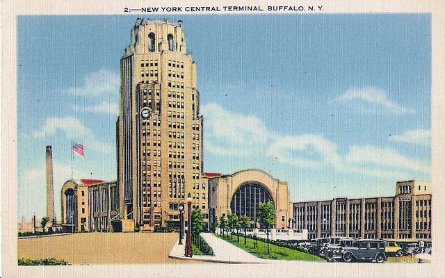
Amtrak in Buffalo Central Terminal?

The state of New York recently gave a 17-member panel $1 million to study a location for a new Buffalo train station in six months. One of the three sites under consideration is Buffalo Central Terminal, a dilapidated architectural gem which is gradually being restored by dedicated volunteers, and two other locations.
State ignores existing station at Depew to focus on one new station
Today, Amtrak passengers arrive via a small downtown Exchange St station with a recently collapsed roof or via a suburban Depew station built quickly by Amtrak. Neither station is ideal, Depew being too small and lacking development opportunities while Exchange St is literally under Interstate 190. Even so, Depew has been completely ignored by the study as only Exchange St, Central Terminal and Larkinville are under consideration and people have interpreted that they can make only one choice among the three. This is a false choice. Rather, Buffalo should revert to its 1962 configuration when trains bound for Niagara Falls served both Central Terminal and Exchange St station.

Buffalo Central Terminal
I propose replacing Depew with Buffalo Central Terminal because it has the most development potential which could help pay for some of the station restoration costs. A Canadian developer is interested in the site and wants trains there too. While the state has promised to provide $25 million for a new station, the Central Terminal Restoration Corporation has estimated renovations to cost as much as $60 million.

Yet, considering the scope of the project, restoration could be cheaper than new construction. For example, the existing parking lot would simply have to be painted, fenced and add security cameras. To connect riders downtown, the city could run an express bus for the Lakeshore Limited, the only one of four trains which does not stop at Exchange St. The building needs a new heating system regardless of whether Amtrak moves there or not. The larger costs would be restoring the walkway to the platform, the platform itself, and tracks, switches and crossovers to and from the station.

Platforms
However, while the old platforms remain, the pedestrian walkway linking them to the station does not and a new one would need to be built. The old walkway was removed to allow for taller freight trains. As a result, the new walkway would have to be built higher. Alternatively, the railway tracks could be lowered to allow the walkway to be replaced at its old height. Keeping it at its old height could reduce the cost of modifying the station at each end of the walk. The walkway would also have to be at least 150’ long. 

For the platforms, there are seven to choose from. I would suggest restoring the 840’ long platform, the 3rd platform in from the station. While the walkway has a ramp to the platforms, it is unclear it complies with ADA’s required 4.8°, but if they are, it would save the cost of an elevator. Fortunately, these platforms are low level platforms which means they would need to be raised about 40 inches to comply with new ADA and Federal Railroad Administration rules. In order to reduce the cost of restoring the platforms and maintain the historic canopy above them, I suggest lowering the track and installing drainage. Alternatively, the platform and canopy could be completely rebuild on top of a taller platform.

Tracks
This location requires some new track which requires some analysis of freight train traffic. This station was closed in 1979 in part because freight train congestion in Frontier Yard slowed or delayed passenger trains. Today, it takes 13-21 minutes for trains to go just 5.5 miles from Depew to Exchange St, averaging 15-25mph, because of Frontier Yard.
The easiest option would be a 1600’ track between the Belt Line’s western and eastern tracks. The Buffalo Belt Line has relatively light freight traffic, 6-7 trains per day, and has two tracks so it can probably accommodate a 4 daily passenger trains at its southern end without costly upgrades. A crossover would be needed west of the station to connect trains from the terminal directly to the tracks leading downtown, allowing passenger trains to avoid the busy main line and reduce delays. However, this option would require Amtrak trains to run through Frontier Yard at 25mph or less and be susceptible to delays from freight trains. This would also require two new switches to move trains into the Terminal.

Reducing travel time and delays through Frontier Yard would ultimately require a bypass track. Virginia is constructing a similar one around Acca Yard in Richmond to reduce the time it takes their trains to go a mere 7 miles from 25 minutes to substantially less. Frontier Yard has a lot of capacity as CSX has reduced the number of freight cars through it and it might be possible to pay CSX, Frontier Yard’s owner, to upgrade the southern track, 6.6 miles long, to a freight yard bypass track, allowing trains to go faster through the yard. This would still require at least two crossovers to allow trains to switch from the southern track to the Central Terminal track, crossing CSX’s busy main line. This would be more costly, $10-25 million and require substantial cooperation from CSX as passenger trains would be essentially taking a track away from freight trains. But if there are benefits for CSX such as getting passenger trains out of its way more quickly and monetary ones, they may be persuadable. Given the $25 million budget though, this project may have to come later.

 Yellow is new track, white is restored platform, dark gray is walkway to platform and light gray is the station's immense parking lot.

Buffalo Exchange St Station
I also propose retaining the Exchange St Station but moving the platform a block west to provide a direct connection to Metrorail from the platform. This would require moving the track over to position the new platform south of it. Some of the station functions could move the Donovan Building’s parking garage and some station amenities could piggyback off of that building’s offerings (train pod anyone?). This parking could be replaced by some of the 820 spaces within the ex-HSBC building or a large garage next to the Bison’s field.

Larkinville
The last site, Larkinville, is probably the least exciting option. It would require a clean sheet design for a station and a new platform. It would not provide the downtown connections Exchange St already does. Development is well underway in Larkinville without a train station.

Conclusion
The choice between Central Terminal, Exchange St, and Larkinville is a false one. The best option would be to convert Central Terminal into a modern train station for a reasonable amount of money while redeveloping the property and surrounding neighborhood. Keeping Exchange St would also maintain an important downtown connection.